Mandalay Travel Guide & Reviews
Age: founded in 1857 AD
Area: 118.4 km²
Population: 6.166 million
Location: Latitude: 21.9588° N, 96.0891° E
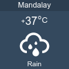
Temperature: Min 18 'C - Max 37 'C
We have 558 guests and no members online
Tapestry Workshop
Throughout Myanmar, Mandalay Shwe-gyi-do Quarter is the best place for embroidery and appliqué work. Materials used in embroidery and appliqué workers include, golden silvery thread, sequins (plastic metal) velvet, satin, colored cloth, paper produced in Shan State and glue from sticky rice. In making an embroidery cloth or a tapestry, the cloth has to stretch on a wooden frame, about one foot high above the ground and embroider on it later.
Throughout Myanmar, Mandalay Shwe-gyi-do Quarter is the best place for embroidery and appliqué work. Materials used in embroidery and appliqué workers include, golden silvery thread, sequins (plastic metal) velvet, satin, colored cloth, paper produced in Shan State and glue from sticky rice. In making an embroidery cloth or a tapestry, the cloth has to stretch on a wooden frame, about one foot high above the ground and embroider on it later.
Yadanabon Zoological Gardens
credit-www.twtmiri.com
info Yadanabon Zoological Garden (ရတနာပုံ တိရိစ္ဆာန် ဥယျာဉ်) is situated in the north of the Royal Palace, at the foot of the Mandalay Hill. Various kinds of animals such as elephants, tigers, lions, deer etc. can be seen.
credit-www.twtmiri.com
info Yadanabon Zoological Garden (ရတနာပုံ တိရိစ္ဆာန် ဥယျာဉ်) is situated in the north of the Royal Palace, at the foot of the Mandalay Hill. Various kinds of animals such as elephants, tigers, lions, deer etc. can be seen.
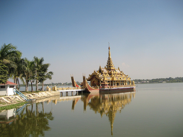
Kandawgyi Lake of Mandalay & Pyi Gyi Mon Royal Barge
Taungpyon
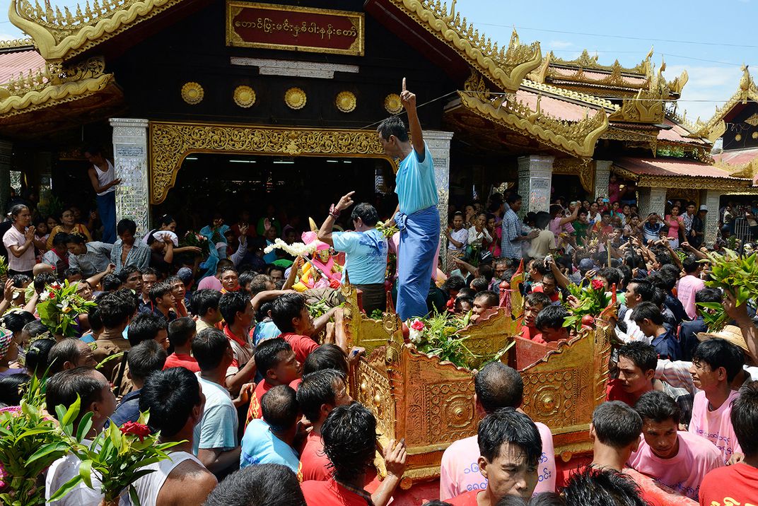
info Taung Pyone (တောင်ပြုံး, often also spelled as Taungpyon) village is located near Mandalay, the site where two brothers serving a king of Bagan in the 11th century were executed and they became powerful spirits or nats.
info Taung Pyone (တောင်ပြုံး, often also spelled as Taungpyon) village is located near Mandalay, the site where two brothers serving a king of Bagan in the 11th century were executed and they became powerful spirits or nats.
Gaw Wein Jetty
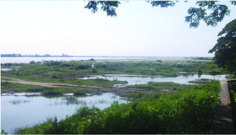
info Gaw Wein Jetty (ဂေါဝိန်ဆိပ်ကမ်း) is a historical Jetty of ancient Mandalay, used by the British to put an end to the Third Myanmar Empire.
info Gaw Wein Jetty (ဂေါဝိန်ဆိပ်ကမ်း) is a historical Jetty of ancient Mandalay, used by the British to put an end to the Third Myanmar Empire.
Asekhan Fort
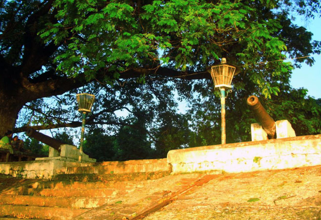
info Sagaing Fortress or Asekhan Fortress is located at Asekhan Quarter which is south to north of Sagaing near the west bank of Ayeyarwaddy River.
info Sagaing Fortress or Asekhan Fortress is located at Asekhan Quarter which is south to north of Sagaing near the west bank of Ayeyarwaddy River.
Zay Cho Market
info Mandalay is full of shopping experience. The new Mandalay Zay Cho (ဈေးချိုတော်) is one of the main market places in Mandalay.
info Mandalay is full of shopping experience. The new Mandalay Zay Cho (ဈေးချိုတော်) is one of the main market places in Mandalay.
The Sanda Muni Cast Buddha Image
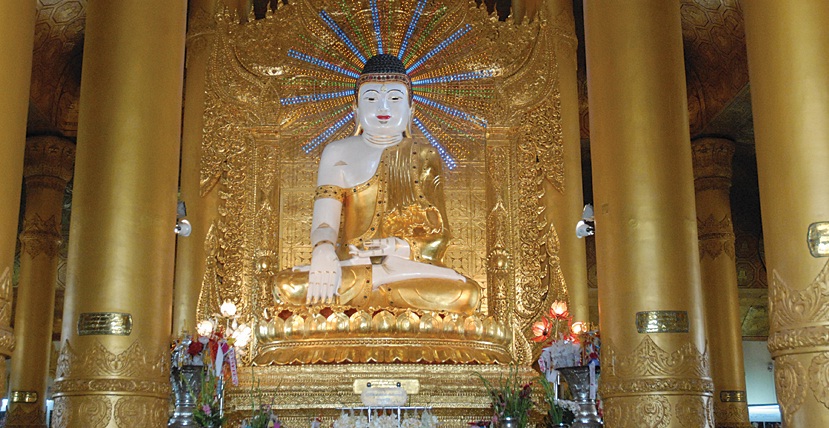
info The Sanda Muni Buddha Image (စန္ဒာမုနိဘုရား) is situated to the east of the Kyauktaw Gyi Pagoda. It was cast by King Bodawpaya before the founding of the city Mandalay.
info The Sanda Muni Buddha Image (စန္ဒာမုနိဘုရား) is situated to the east of the Kyauktaw Gyi Pagoda. It was cast by King Bodawpaya before the founding of the city Mandalay.
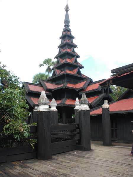
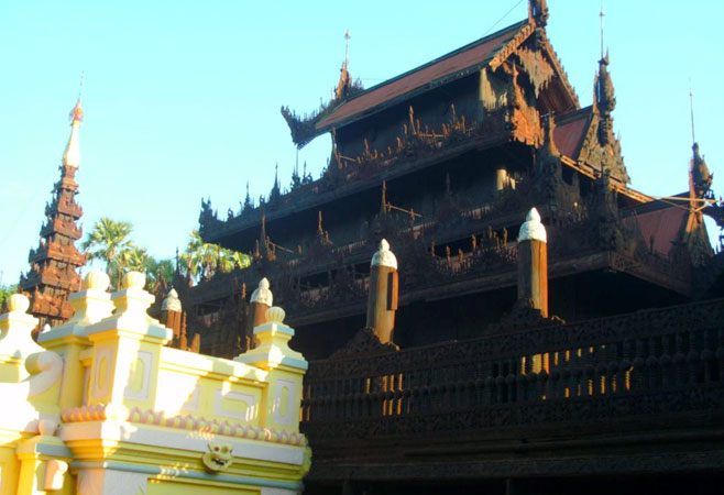
info Bargaya Monastery (ဘားဂရာ ကျောင်း) was built in 1834 A.D, during the reign of King Bagyidaw. Being built entirely of teak wood, the monastery has 267 gigantic teak wood posts. The biggest post measuring 60 feet high and 9 feet in circumference. The monastery is a structure of great dimension for it is 188 feet in lenght and 103 feet in breadth.
Myingyan
credit-www.panoramio.com
info The climate is dry, with high south winds from March until September. The annual rainfall averages about 35 in. The temperature varies between 106 and 70 Fahrenheit. The ordinary crops are millet, sesame, cotton, maize, rice and a great variety of peas and beans. There are no forests, but a great deal of low scrubland.
Photo Credit - www.mandalayairport.com
info Mandalay International Airport (မန္တလေး အပြည်ပြည်ဆိုင်ရာ လေဆိပ်) is the sole international airport in Mandalay Division, Central Myanmar.
info Mandalay International Airport (မန္တလေး အပြည်ပြည်ဆိုင်ရာ လေဆိပ်) is the sole international airport in Mandalay Division, Central Myanmar.
Peik Chin Myaung Cave (Maha Nandamu Cave)
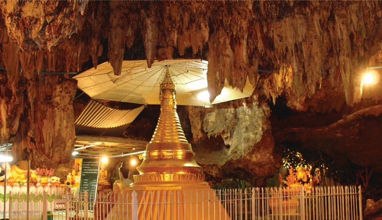
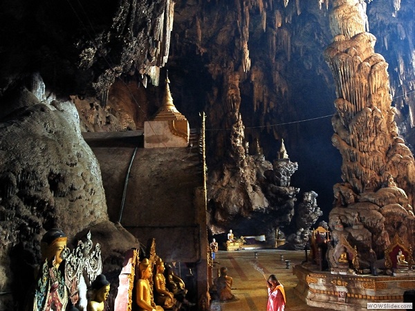
info Peik Chin Myaung Cave (ပိတ်ချင်းမြောင် မဟာနန္ဒမူလိုဏ်ဂူတော်) is located near Wetwun village, 12 miles (19km) north east of Pyin Oo Lwin and it is 3 miles south of the village, easily accessible by car.
info Peik Chin Myaung Cave (ပိတ်ချင်းမြောင် မဟာနန္ဒမူလိုဏ်ဂူတော်) is located near Wetwun village, 12 miles (19km) north east of Pyin Oo Lwin and it is 3 miles south of the village, easily accessible by car.
Kyauktawgyi Pagoda
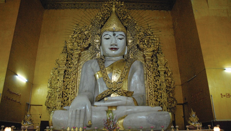
info Kyauktawgyi Pagoda (ကျောက်တော်ကြီးဘုရား) donated by King Mindon in 1853, is located near the southern entry of Mandalay Hill.
info Kyauktawgyi Pagoda (ကျောက်တော်ကြီးဘုရား) donated by King Mindon in 1853, is located near the southern entry of Mandalay Hill.
Food in Mandalay
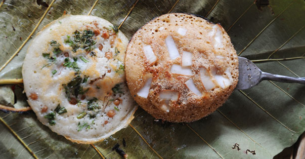
Mandalay is a city with great historical heritage. Many traditional food can be tasted in this city.
Mandalay is a city with great historical heritage. Many traditional food can be tasted in this city.
Mandalay Hill
The Mandalay Hill is situated to the north-east corner of the Mandalay Royal Palace. It lies from north to south, its altitude being 236.5m above sea level and its height going up to 167.64m.
The Mandalay Hill is situated to the north-east corner of the Mandalay Royal Palace. It lies from north to south, its altitude being 236.5m above sea level and its height going up to 167.64m.
Tagaung City
info Tagaung (တကောင်း) is situated on the east bank of the river Ayeyarwaddy, 127 miles (204km) north of Mandalay and 56 miles (90km) north of Shwe Bo.
info Tagaung (တကောင်း) is situated on the east bank of the river Ayeyarwaddy, 127 miles (204km) north of Mandalay and 56 miles (90km) north of Shwe Bo.
Dat Taw Taung Cave
Credit Photo - www.theodora.com
info Dat Taw Taung Cave is situated in Kyaukse. Mandalay Region. Mountain Festival (Dat-taw-taungpwe) is usually held on 14th waxing day and Tabaung full moon day. Buddha images from the caves are worshipped.
Credit Photo - www.theodora.com
info Dat Taw Taung Cave is situated in Kyaukse. Mandalay Region. Mountain Festival (Dat-taw-taungpwe) is usually held on 14th waxing day and Tabaung full moon day. Buddha images from the caves are worshipped.
Dattawgyaik Waterfall
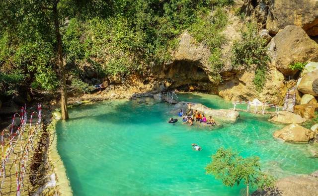
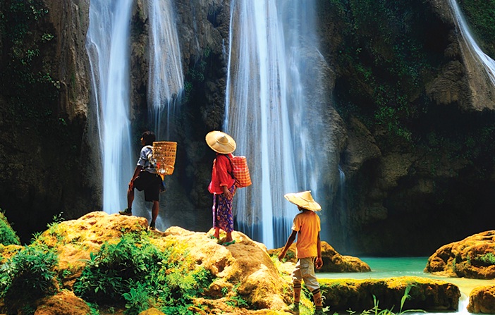
info The Dattawgyaik Waterfall (ဓါတ်တော်ချိုင့် ရေတံခွန်) is located in Ani Sakhan which is the half way point between Mandalay and Pyin Oo Lwin.
info The Dattawgyaik Waterfall (ဓါတ်တော်ချိုင့် ရေတံခွန်) is located in Ani Sakhan which is the half way point between Mandalay and Pyin Oo Lwin.
Mandalay Palace
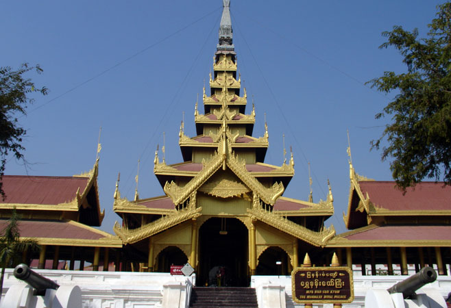
info The Mandalay Hill is situated to the north-east corner of the Mandalay Royal Palace. It lies from north to south, its altitude being 236.5m above sea level and its height going up to 167.64m.
info The Mandalay Hill is situated to the north-east corner of the Mandalay Royal Palace. It lies from north to south, its altitude being 236.5m above sea level and its height going up to 167.64m.
Shweinbin Monastery
info Shweinbin Monastery (ရွှေအင်းပင် ဘုန်းကြီးကျောင်း) is located at the southwest corner of Mandalay City.
info Shweinbin Monastery (ရွှေအင်းပင် ဘုန်းကြီးကျောင်း) is located at the southwest corner of Mandalay City.
Innwa Bridge
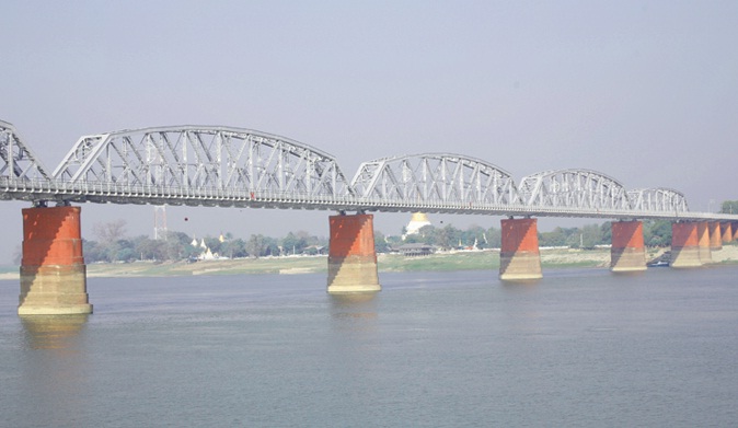
info This British-engineered 16-span bridge, which dated back to 1934, was the only structure that spanned the Ayeyarwaddy River. Inwa Bridge (အင်းဝတံတား) (formerly Ava Bridge) was closed in 1942 when two spans got demolished in order to delay the advancing Japanese Forces.
info This British-engineered 16-span bridge, which dated back to 1934, was the only structure that spanned the Ayeyarwaddy River. Inwa Bridge (အင်းဝတံတား) (formerly Ava Bridge) was closed in 1942 when two spans got demolished in order to delay the advancing Japanese Forces.
Pwe Kauk Waterfall
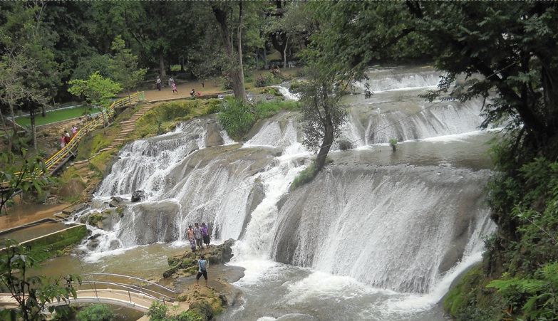
info Pwe Kauk Waterfall is located about 8km from Pyin Oo Lwin. It is also called Hampshire Falls in British times. It’s a very pleasant picnic spot.
info Pwe Kauk Waterfall is located about 8km from Pyin Oo Lwin. It is also called Hampshire Falls in British times. It’s a very pleasant picnic spot.
Maha Anthtoo Kanthar Pagoda
info The building of the Maha Ant Htoo Kan Thar Pagoda (မဟာအံ့ထူးကံသာ မြတ်စွာဘုရား) has a history of its own.
info The building of the Maha Ant Htoo Kan Thar Pagoda (မဟာအံ့ထူးကံသာ မြတ်စွာဘုရား) has a history of its own.
Sandamuni Pagoda
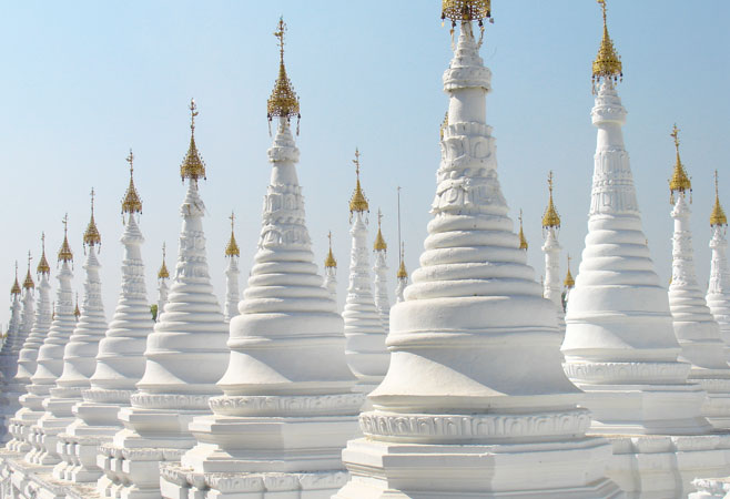
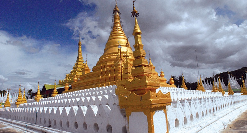
info The Sandamuni Pagoda (စန္ဒာမုနိဘုရား) is located to the southeast of Mandalay Hill and bears a resemblance to the nearby Kuthodaw pagoda because of the large number of slender whitewashed ancillary stupas on the grounds.
info The Sandamuni Pagoda (စန္ဒာမုနိဘုရား) is located to the southeast of Mandalay Hill and bears a resemblance to the nearby Kuthodaw pagoda because of the large number of slender whitewashed ancillary stupas on the grounds.
Maha Aung Mye Bon Zan Monastery (Me Nu Oak Kyaung)
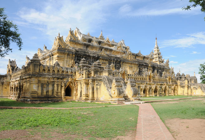
info Maha Aung Mye Bon Zan Monastery well known as Me Nu Oak Kyaung or the Brick Monastery was built by Nanmadaw Me Nu, Chief Queen of King Bagyidaw in 1818.
info Maha Aung Mye Bon Zan Monastery well known as Me Nu Oak Kyaung or the Brick Monastery was built by Nanmadaw Me Nu, Chief Queen of King Bagyidaw in 1818.


