Kayin State

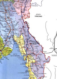
 info Kayin State lies between 15o 12'N and 19o 28'N latitudes and 96o 23'E and 98o 56'E longitudes on the east of Myanmar. It has common borders with Mandalay Division and Shan State on the north. Kayah State and Thailand on the east. Mon State and Bago Division on the west. Its area is 11.731 square miles.
monetization_on No entry fees
watch_later Operation hours: n.a
hourglass_full Time needed: Approximately 3 hour

Area & population
Together with Sagaw Kayins. Po Kayins. Bwe Kayins and Pako Kayins. Shans. Paos. Myanmarns. and Mons also live in Kayin State. comprising seven Townships and 410 Wards and Village-Tracts. Its population is about 1.057.505. The State Day falls on 7th November and the Capital is Hpa An.
Resources
Principal crops cultivated are paddy. groundnut. sesame. tobacco. betel nut. sugar-cane and rubber. Its natural resources include iron. lead. copper. tin. antimony and tungsten. Over half the area of the State is covered with evergreen forests that produce valuable teak and pyinkado and other woods.
The State has 13 State enterprises and is easily accessible from Mon State via the well-Known Donthami river bridge. Thandaung is also a hill station of this state. There are several streams and waterfalls in this area. for studying the nature.
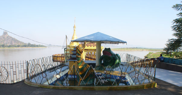
Now. the Thanlwin Bridge crossing the mighty Thanlwin river has been constructed and accessibility became more convenient to the state. Mount Zwegabin is the landmark of Kayin State.

A Kayin Couple

Map of Kayin State
build Year established: n.a.
directions Directions:
place Kayin State
local_phone n.a.
email no email
public no web site
local_taxi Estimated taxi fare: n.a.
directions_bus Bus directions: n.a.
directions_railway Train directions: n.a.
map See map below:
help_outline Get a free quotation for a Myanmar tour to visit this place.
grade Give a star-rating on this place or write a FB comment below:


